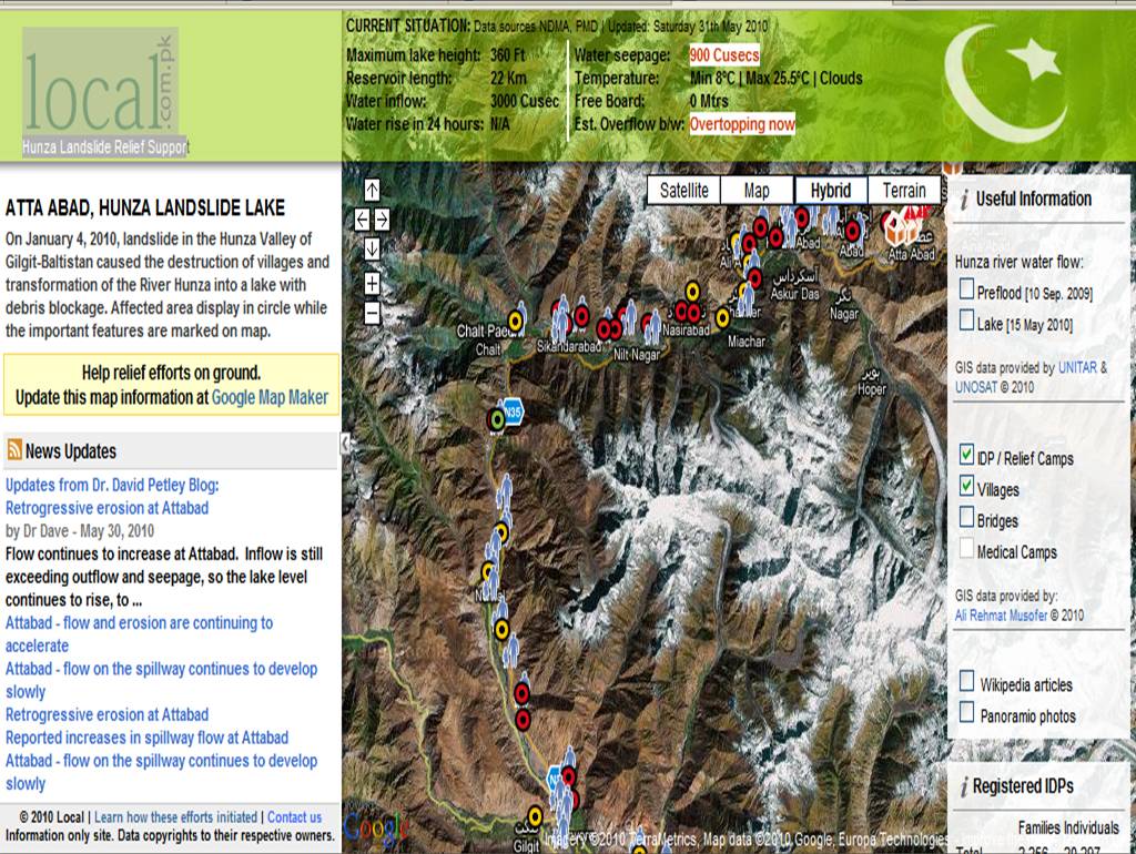
 Two Google Map users from Lahore and London, respectively, Omer Shiek and Jabran Rafique, created a website, http://www.local.com.pk/hunza/, which provides data for disaster risk management in Pakistan. Google Maps have made the publishing of post-disaster imagery possible which allowed Shiek and Rafique to identify the locations of health centers and shelters. The website is recognized in the UN-SPIDER as a primary source of information in the Hunza disaster. UN-SPIDER provides universal access to all types of space-based information and services relevant to disaster management.
Jabran stated that the gap in the map information was obvious. He added that they have used the Google map maker as their baseline data, and started adding other features like roads, submerged areas and roads.
“We hope that our effort to make reliable information more widely available will help disaster relief managers and decision makers save lives and prevent more damage to the fragile economy of this remote region. In contributing to Google Map Maker, my desire is to establish a basic framework around which we can document, understand and bring transparency to the events taking place around me. We, as a mapping community, need to better demonstrate the benefits of online collaboration and the utility of tools such as Map Maker for rapid dissemination of information”, said Omer, when asked about their motivation for this project.
Source:
Google Lat Long Blog
http://google-latlong.blogspot.com/2010/06/map-makers-respond-to-pakistan.html?utm_source=feedburner&utm_medium=feed&utm_campaign=Feed:+blogspot/SbSV+(Google+LatLong)&utm_content=Google+Reader
UN-SPIDER
http://www.un-spider.org/
No comments:
Post a Comment